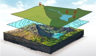
GIS is a framework for gathering, managing, and analyzing data. Using the principles of geographic science, it integrates many types of geospatial data, analyzes their relationships, and organizes them in layers of information for visualization and improved understanding. This course focuses on ESRI’s ArcGIS software, the industry standard. Jack Dangermond, CEO of ESRI, describes GIS as “uncovering meaning and insights from within data.”
Participants in this course will learn GIS concepts, tools, and processing applicable to problems in a variety of fields. The course is designed for self-study with lessons covering GIS applications on real-world problems, and prepares learners for more advanced applications such as 3D GIS and GIS Image Analysis, the two other courses in the GIS Essentials Professional Certificate.
GIS, once an esoteric technology limited to geographers and data scientists, is now available to everyone. Thousands of organizations in virtually every field are using GIS to analyze data, make maps that reveal patterns and relationships, share insights, and solve complex problems of local to global significance.
Verified track learners will receive an ArcGIS Pro license in addition to unlimited course access and a verified certificate.